Problem
State DOTs need a better way to compare their operations with other states with similar weather severity in order to identify opportunities for reducing spending that will not negatively impact level of service.
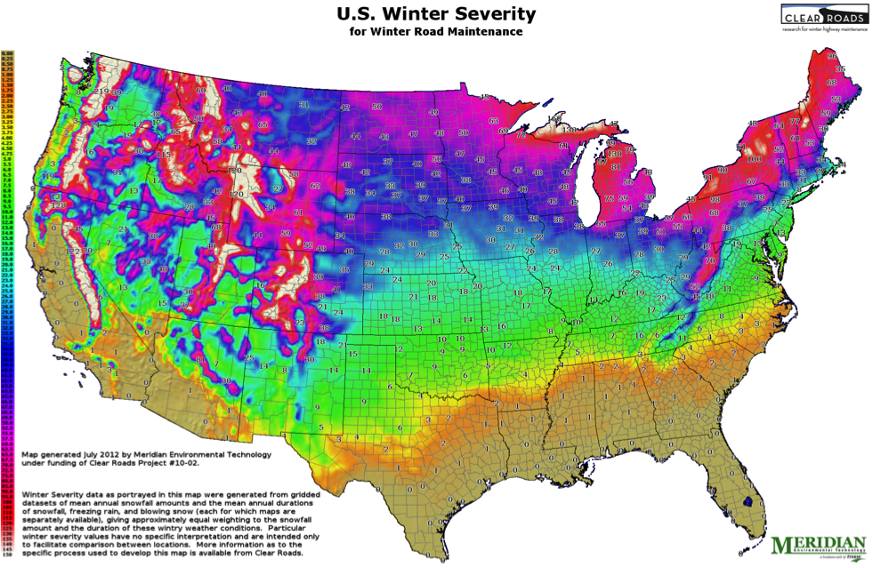
Objective
The goals of this research were to analyze weather severity in the snow and ice states and develop a methodology to map weather severity across the regions and states.
Results
A series of maps that depict winter weather severity across the U.S. in a manner similar to the plant hardiness zone maps used for agriculture. The weather data was compiled from the National Weather Service and Federal Aviation Administration from 2000 to 2010.
See the article in the September 2013 Winter Maintenance supplement of Roads & Bridges magazine.